Clear entry
A participant can start from a phone without figuring out where to write, what to attach or how to name files.
Digital platform
Field observations on a convenient web platform plus an observation management system for scientists. This is more than a submission form: it includes a workspace for checking data, seeing statuses, mapping findings, contacting participants and preparing material for analysis.
About the platform
We turned field scientific volunteering into a format that is easy to open right where a finding happens.
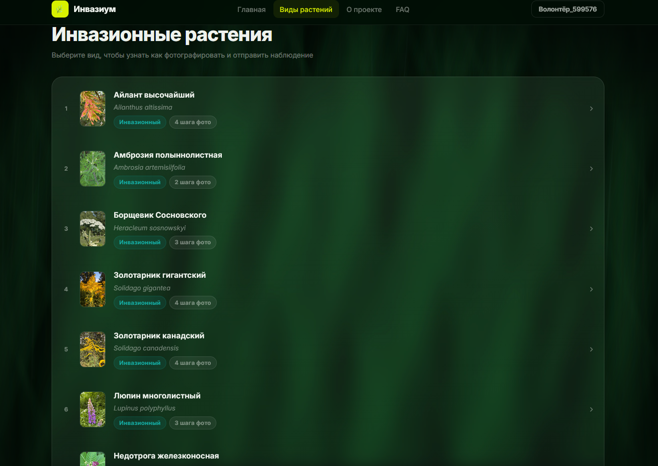
Invazium works as a web platform: a person sees a list of invasive plants, chooses a species, checks the card and sends an observation without installing a separate app.
The main task was not to make a pretty showcase, but to remove friction between “I found a plant” and “the data is already with the researchers”.
Participant journey
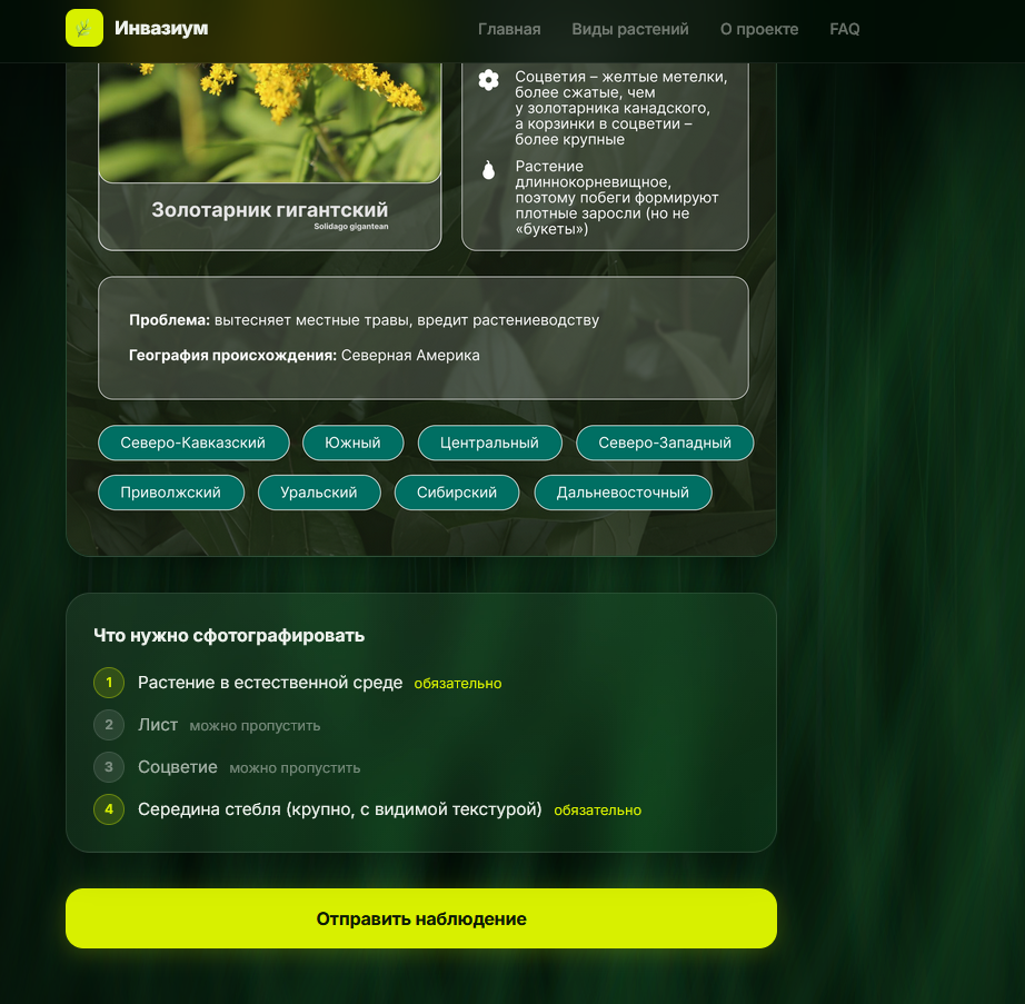
Participants need to choose a plant, take the right photos, mark the place and not get lost along the way. The platform therefore moves step by step: description, prompts, photos of different plant parts and geolocation.
Even the first attempt does not turn into a multi-page instruction manual. Each required action appears when it is actually needed.
Sign-in is familiar: email, VK or Yandex ID. At the same time, the platform remains independent and can keep developing without being tied to one external channel.
What the platform covers
A participant can start from a phone without figuring out where to write, what to attach or how to name files.
Plant information sits next to the action: read, check, send the observation.
Photos, coordinates, plant species and participant data are collected in one order instead of scattering across chats.
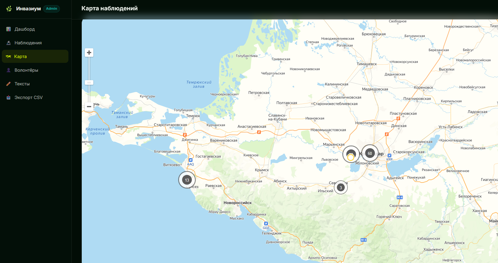
Scientists and coordinators get an environment where observations can be checked, compared and prepared for analysis.
For the research team
We designed not only for the volunteer, but also for the people who later work with thousands of observations.
The platform collects data in a form that can be reviewed and used later: observations, photos, geotags, statuses, participant contact and DobroID for volunteer hours. In spirit, it is a lightweight CRM for the research team, shaped around field science.
That matters especially for projects spread across many regions. When participants are far apart, the platform keeps the process coherent: the same steps, the same logic and clear data at the end.
Geodata
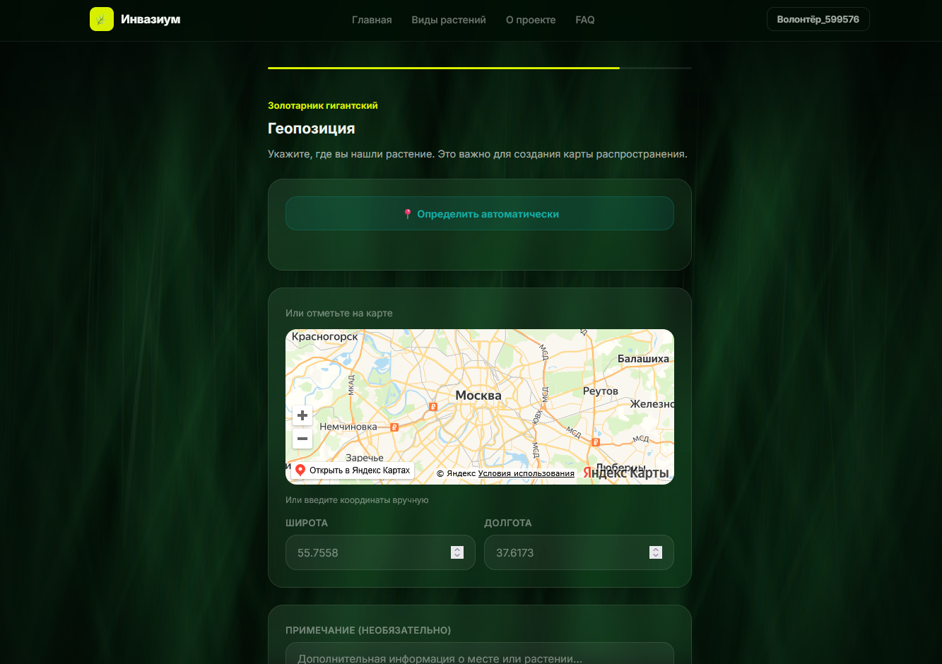
Scientific work needs not only a plant photo, but also the finding location. The submission flow therefore leads participants to geolocation: they can detect the point automatically, mark it on the map or enter coordinates manually.
Data therefore arrives ready for further work: comparing territories, seeing species spread and checking observations not only by photo but also by place.
Context
Invazium grew from a real task: gather a large volume of field data without losing quality.
The project focuses on invasive plants: species that spread quickly in new territories and change ecosystems. In the first season, according to the Science.rf portal, volunteers sent more than 15 thousand records from different regions of Russia.
Our part of that story is the digital infrastructure. We built an environment where participation is easier and collected material is easier to carry into scientific work: review, mapping, analysis and reporting.
The platform matters where a scientific task meets a real participant. We built Invazium as a working tool: quick entry for the volunteer, a clear observation flow and a management system the research team can continue working with.
The project page is separate from the platform itself: here we describe what was built, while observations are collected in a dedicated space.